One Day in Theodore Roosevelt National Park: Three Honest South Unit Plans
The South Unit loop is whole again. Here is how to spend one realistic day, with an overlook-first plan, a short-hike plan, and a flexible route for children or limited walking.
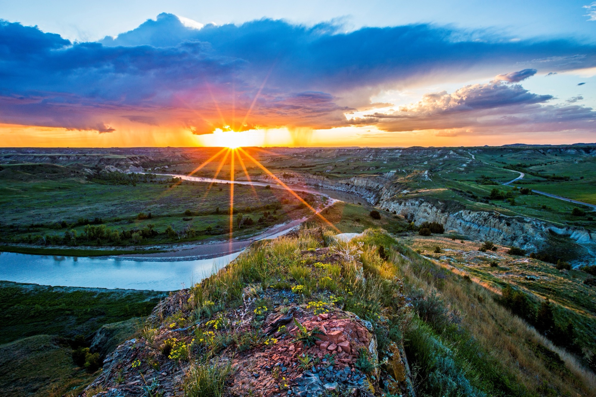
The Badlands spent six years proving the name was not decorative.
Heavy rain in 2019 sent parts of Theodore Roosevelt National Park’s South Unit road sliding downhill. For years, a map that appeared to show a loop behaved like an out-and-back. Then, in November 2025, the National Park Service reopened the repaired section. The current South Unit page describes the full Scenic Loop Drive as 36 miles and says the loop is whole again; some older NPS pages still show shorter figures, so use the current park map and alerts rather than an old screenshot.
That changes a one-day visit. It does not make the day infinitely expandable.
The National Park Service says to allow at least two hours just to drive the paved loop. Add the visitor center, a picnic, four overlooks, prairie dogs that refuse to work on a schedule and two short walks, and the honest total becomes six to eight hours. Travelers who prefer to remain near the vehicle can have a strong visit in three and a half to five hours. A group moving slowly, earning a Junior Ranger badge or using hard-surfaced routes should reserve four to six hours and protect the option to stop early.
The right South Unit day is not the one with the most pins. It is the one whose pace still leaves you looking when the road makes its final bend.
Research note: This is a desk-researched planning guide, not a claim that our editors personally drove or tested these itineraries. Park facts and official trail estimates were checked against National Park Service sources on August 8, 2026. Total itinerary times are editorial planning ranges. Roads, weather, wildlife, facilities and individual pace can change the result.
The useful answer at a glance
- Choose the South Unit for this day. Its entrance and visitor center are in Medora, directly off I-94. The North Unit is a separate trip.
- Use Mountain Time. The South Unit and its visitor schedules operate on Mountain Time, one hour behind Bismarck and Fargo.
- Enter at the actual park entrance. For mobile maps, use 201 East River Road North, Medora, ND 58645. Painted Canyon at I-94 Exit 32 is an overlook and seasonal visitor center, not the Scenic Loop entrance.
- Allow at least two hours for the 36-mile loop before stops. A meaningful day usually needs four to eight hours, depending on the plan below.
- No timed entry is required. As rechecked September 8, 2026, a seven-day private-vehicle pass is $30, a motorcycle pass $25, and an individual pass for a visitor age 16 or older entering without a motor vehicle $15. Verify current fees before leaving.
- Bring a card or digital payment. In-park fee collection became cashless on May 1, 2026. Buying and saving a digital pass before arrival is the simplest backup.
- Bring lunch and more water than seems elegant. There are no restaurants, hotels, fuel stations or grocery shops inside the park; visitor centers, campgrounds and some restrooms have their own operating schedules. Medora has food and fuel; services shrink in winter.
- Check two pages that morning: park alerts and road status and the South Unit weather forecast.
- Keep at least 100 feet from bison and at least 25 yards from other wildlife. Obey any stricter posted or ranger direction. If a bison occupies the road, remain in the vehicle and wait.
First, decide what “one day” means
Theodore Roosevelt National Park is not one continuous parcel. The South Unit, North Unit and Elkhorn Ranch Unit are separated by public roads and large distances. The National Park Service currently estimates about one hour and ten minutes between the South and North Unit entrances in ordinary conditions. That is transfer time, not sightseeing time.
Trying to complete both units in a single day turns their scenic roads into commutes. This guide keeps the entire day in the South Unit, with Painted Canyon as an optional separate stop. If you are still choosing, our North Unit vs. South Unit guide compares drive time, walks, services, access and the time-zone change. Our statewide field guide explains when the North Unit deserves another half day or more. If you are arriving from the east, the Fargo-to-Medora road-trip guide gives the crossing its own realistic clock.
The South Unit’s present loop also carries a recent lesson about the landscape. The 2019 slides damaged more than six miles of roadway. The repair stabilized banks, rebuilt road base, improved drainage and resurfaced the corridor before the full loop reopened in November 2025. Erosion is not merely something an exhibit explains here. It is still designing the place.
The landscape did not begin with Roosevelt
The name on the park can compress the story if visitors let it.
The Little Missouri River basin lay within traditional Mandan and Hidatsa bison-hunting grounds. Crow people used the western edge of the Badlands, and Arikara, Lakota, Assiniboine and other Northern Plains peoples have distinct histories and associations with this country. Archaeological and oral-history evidence documents hunting, gathering, travel and spiritual use long before railroad towns or cattle ranches appeared. The National Park Service’s cultural history is an official starting point, not a substitute for tribally led history.
Theodore Roosevelt arrived in Dakota Territory in 1883 to hunt bison and invested in the Maltese Cross Ranch. The cabin built for that operation now stands behind the South Unit Visitor Center. Its preservation makes a useful beginning to the day, but not the beginning of the land’s human story.
Then take the loop. It moves from grassland to exposed clay, from prairie dog towns to river-bottom cottonwoods, from broad tabletop country to buttes that look assembled from ash, rust and old gold. The three plans below see the same country at different speeds.
Choose your South Unit day
| Plan | Best for | Honest total | Walking commitment | What you give up |
|---|---|---|---|---|
| 1. The whole loop, almost no hiking | First visit, half day, uncertain weather, tired travelers | 3½–5 hr | A few short walks from the car | Trail-level detail and a slow sunset stop |
| 2. The short-hike day | Active adults, teens and older children in dry, moderate conditions | 6–8 hr | Two short trails; optional third | Time for every overlook and a second attraction |
| 3. The flexible family or lower-strain day | Young children, wheelchair users, limited stamina, mixed-pace groups | 4–6 hr | Modular hard-surfaced stops; no required dirt trail | Completing every stop on the loop |
These are not schedules down to the minute. A bison in the road can add twenty quiet minutes. A thunderstorm can remove an entire trail. That is not itinerary failure. It is the park asserting the terms.
Plan 1: The whole loop, almost no hiking
Choose this plan when: scenery matters more than mileage on foot, the group has half a day, or heat, wind and uncertain energy make a trail-heavy promise unwise.
1. Begin with the visitor center, but do not wait for it to open
The park itself is open 24 hours a day, year-round. The visitor center is not. If its current hours fit, allow 30–45 minutes for the 17-minute park film, small museum and Maltese Cross Cabin. Ask a ranger which loop direction makes sense that day and where wildlife has recently affected traffic.
If the building is closed, start the road. The landscape does not keep office hours.
2. Make Skyline Vista the test stop
The National Park Service lists Skyline Vista as a flat, paved 0.1-mile trail with a 10-minute round-trip estimate. Treat it as a test: if the exposure, heat or wind already feels like work, keep the rest of the day overlook-first. There is no prize for turning a sensible drive into an uncomfortable march.
3. Let one prairie dog town take longer than expected
Three large prairie dog towns are visible from the South Unit road. Choose one developed viewing area, park fully off the roadway and listen. A colony is not a single-animal photograph. It is an argument conducted through alarm calls, upright sentries and burrow entrances.
Do not enter a burrow area, feed an animal or step closer for a phone shot. The correct wildlife lens is usually the one that makes distance possible.
4. Choose four overlooks, not all of them
A strong no-hike set is River Woodland Overlook, Badlands Overlook, Scoria Point Overlook and Boicourt Overlook. Each changes the subject: river habitat, the larger broken landscape, the brick-red rock locally called scoria and a broad Badlands view. The park’s accessibility page identifies sidewalks or hard-surfaced viewing at these locations, but current construction, weather and individual access needs still control.
If a pullout is full, keep moving. Another overlook is not a consolation prize here.
5. Finish the loop without inventing a wildlife guarantee
Bison, mule deer, prairie dogs and horses may be visible from the road. “May” is the important word. The National Park Service says driving usually creates the best wildlife-viewing opportunity because visitors cover more habitat while remaining inside a vehicle. It does not schedule an animal for the final mile.
Planning total: if used, 30–45 minutes at the visitor center; at least two hours of loop driving; roughly 60–90 minutes across selected stops; plus wildlife and restroom delay. Allow 3½–5 hours when the visitor center is skipped or closed, and nearer the high end when it is part of the day.
Plan 2: The short-hike day
Choose this plan when: the forecast is moderate, trails are dry, everyone has closed-toe footwear and the group wants to feel the Badlands underfoot without committing to backcountry mileage.
Start early. Summer shade is scarce, and the official trail times below are NPS estimates: not promises about children, photography, footing, altitude tolerance or a bison near the path.
1. Warm up at Skyline Vista
Use the same 0.1-mile, 10-minute paved route as Plan 1. It reveals whether today’s wind and temperature agree with the plan before the group reaches a more committing trail.
2. Choose Coal Vein for geology
The Coal Vein Trail has a 0.6-mile inner loop and 0.8-mile outer loop, with an official 30–45-minute allowance. It is classified easy to moderate and has stairs. The underground fire that gave the trail its name is no longer burning, but the walk explains how geology, vegetation and erosion change together.
After rain, skip it unless a ranger says the tread is suitable. Bentonite clay can remain slick and build onto shoes for days; the park warns that some routes become nearly impassable when wet.
3. Add Buck Hill only if the day still feels generous
Buck Hill is only 0.2 mile round trip and the NPS estimate is 15 minutes, but “short” is not the same as “level.” The route is steep and includes stairs. Use the sidewalk and exhibit near the parking area if the climb is wrong for anyone in the group.
4. Save Wind Canyon for the second main walk
The Wind Canyon Trail is 0.4 mile round trip with an official 20-minute estimate. It climbs beside a wind-shaped canyon to a view of the Little Missouri River. The trail surface is dirt and gravel and includes stairs; the parking area’s sidewalk is the lower-strain alternative.
Wind Canyon is often recommended for sunset, but sunset is not automatically the safest appointment. Check the forecast, leave enough light to return to the vehicle and remember that wildlife becomes harder to see on the road after dusk.
5. Use overlooks as recovery, not collectibles
Between walks, stop at prairie dog viewing areas and two or three overlooks. Eat a packed lunch at a designated picnic area. If Coal Vein and Wind Canyon were enough, believe the evidence. The loop does not become more complete because everyone is tired at Boicourt.
Planning total: the two default hikes account for 50–65 minutes of official trail time; Skyline and optional Buck Hill add up to 25 minutes. With the two-hour loop, visitor center, lunch, overlooks and wildlife delay, allow 6–8 hours.
The short-trail clock
| South Unit trail | NPS round-trip distance | NPS time | Important caveat |
|---|---|---|---|
| Skyline Vista | 0.1 mi | 10 min | Flat and paved; exposed to weather |
| Boicourt Overlook | 0.2 mi | 15 min | Hard-surfaced with slight/minimal grade |
| Buck Hill | 0.2 mi | 15 min | Short but steep; paved/gravel with stairs |
| Wind Canyon | 0.4 mi | 20 min | Dirt/gravel with stairs; exposed viewpoint |
| Coal Vein inner/outer loops | 0.6/0.8 mi | 30–45 min | Easy to moderate; stairs; poor choice when wet |
| Painted Canyon Nature Trail | 0.9 mi | 45 min | Separate I-94 access; descent means a climb back out |
Trail figures come from the park’s official hiking guide. Confirm that a route is open before treating any row as today’s plan.
Plan 3: The flexible family or lower-strain day
Choose this plan when: a child’s attention span, a wheelchair or mobility device, pain, fatigue, balance, sensory load or a mixed-pace group should control the day.
Those needs are not interchangeable. This plan is modular on purpose. Use the access details that fit the actual traveler; do not assume that a stop described as good for children meets a mobility need, or that a wheelchair-accessible surface solves heat, distance, sensory or fatigue concerns.
1. Give the visitor center a job
The South Unit Visitor Center and Maltese Cross Cabin are listed as wheelchair accessible. The park film offers closed captions. Families can pick up a free Junior Ranger book at any park visitor center; completing it can turn repeated pullouts into one continuing project rather than a series of adult-requested views.
Allow 45–60 minutes if the building is open and the Junior Ranger program is part of the day. Verify current hours first.
2. Build the loop from known hard-surfaced stops
The park identifies Skyline Vista and Boicourt Overlook as short, hard-surfaced trails with minimal slope. It also lists wheelchair-accessible pullouts or overlooks at:
- River Woodland Overlook;
- the Prairie Dog Town near the loop-road junction;
- Scoria Point Overlook;
- Badlands Overlook;
- Beef Corral Prairie Dog Town; and
- the Wind Canyon parking area’s sidewalk, not the dirt-and-gravel trail.
Choose three or four based on weather and energy. Conditions at a particular curb, parking space or surface can change; visitors who need exact measurements or device-specific guidance should call the park at 701-623-4466 before the trip and confirm again with a ranger.
3. Put the picnic and restrooms on the route before anyone needs them
The accessibility guide lists accessible restrooms and pavilions at South Unit picnic areas. Along the loop, it identifies an accessible restroom near the road to Buck Hill and another at Halliday Well; Cottonwood also provides developed restroom access, though water and some facilities are seasonal.
Pack lunch in Medora and use the stop as the middle of the day. The loop has no restaurant or convenience store waiting after the next hill.
4. Give children two reliable subjects
The Maltese Cross Cabin is small enough to comprehend. Prairie dog towns move, call and reward watching. Those are firmer anchors than promising bison, horses or a ranger program at a particular time.
Let a child choose the next overlook or work on the Junior Ranger booklet. End after the badge, the picnic or the third good view if that is where attention ends. Completing the asphalt is not more important than completing the day in good humor.
5. Know which short routes are not the mobility route
The Buck Hill trail includes stairs. The Wind Canyon trail is dirt and gravel with stairs. Coal Vein also has stairs. Do not let the word “short” make the access decision. The parking-area sidewalks and developed overlooks preserve much of the view without turning those trails into obligations.
Planning total: visitor center and cabin, two prairie dog or wildlife stops, three or four hard-surfaced views, a picnic and generous transitions. Allow 4–6 hours, with permission to leave sooner.
Heat, wind or rain: the plan that replaces the plan
The Badlands have little shade. Summer temperatures can reach the 90s and above, wind is considerable year-round, and severe thunderstorms can develop quickly. The park recommends roughly one liter of water per person per hour while hiking. That is a safety guideline, not a challenge to carry the day through dangerous heat.
If the day is hot
- Start at first light or as early as practical.
- Use Plan 1 or Plan 3 and make the visitor center the midday pause if it is open.
- Cut Coal Vein and Buck Hill first; their brevity does not create shade.
- Carry the day’s water rather than depending on a seasonal refill.
If the wind is strong
- Treat Skyline Vista, Buck Hill, Boicourt and Wind Canyon as exposed choices, not scheduled obligations.
- Use the visitor center, cabin and lower sidewalk viewpoints if they remain comfortable and open.
- Keep control of vehicle doors and loose hats, maps and food packaging.
- If balance or safe vehicle entry is affected, end the stop. The overlook will still exist tomorrow.
If it has rained or a storm is building
- Ask a ranger about trail surfaces. Bentonite clay can remain slippery after the sky clears.
- Replace dirt trails with developed overlooks only if roads remain open and conditions are safe.
- Do not wait on an exposed rim for a dramatic storm photograph.
- Check current alerts again; road and trail restrictions can be added during the day.
Smoke and haze can also erase the long view without closing the road. A one-day itinerary cannot bargain with visibility. If the forecast or air quality makes outdoor time unwise, shorten the park day rather than forcing a checklist through it.
Bison get the right of way
Use the stricter current guidance where official pages differ: maintain at least 100 feet (30 meters, or about two bus lengths) from bison and at least 25 yards from other wildlife. Obey any greater distance posted in the park or given by a ranger. If an animal changes behavior because of your approach, you are already too close.
When a bison stands in the road, be patient, stay in the vehicle and watch quietly. On a trail, turn around or make a wide detour while preserving the required distance. Do not use a prairie dog town as a place to test how close a phone camera can focus.
Wildlife delay belongs in the schedule. It is the only traffic jam most visitors hope to meet.
Rattlesnakes are present. Do not place hands or feet where you cannot see, and do not reach into prairie dog burrows. Ticks are a concern in late spring and early summer. Steep edges, soft sediment and hidden erosion create hazards even when no animal is visible.
What to settle before leaving Medora
If the new presidential library is also part of the trip, do not treat it as the park’s indoor visitor center. It is a separate half-day-or-longer destination with timed admission; use our first-visit Theodore Roosevelt Presidential Library guide and put the two full experiences on different days.
- Save the current alerts, map and pass. Do not assume every part of the loop has dependable service.
- Fill the tank and buy food. The park has no dining, lodging or general store.
- Carry water, sun protection, layers and closed-toe footwear. Wind and temperature can change the feel of a short route quickly.
- Use Mountain Time for every South Unit plan. A phone that recently crossed a time-zone boundary deserves verification.
- Ask about road direction, trail condition, recent wildlife and restroom status. Those four ranger answers are more valuable than another saved “must-see” list.
- Leave the pet plan outside the trails. Pets are prohibited on all park trails and in the backcountry. Leashed pets may use roadsides, sidewalks, parking areas, campgrounds and picnic areas; never leave one unattended, and keep extra distance from wildlife.
Large RVs and trailers can use the paved scenic road, but some sections are narrow and sharply curved. Follow posted limits, use only pullouts that fit the vehicle and do not stop in the travel lane for wildlife or photographs.
Where Painted Canyon fits
Painted Canyon Visitor Center and Overlook sit at I-94 Exit 32, seven miles east of Medora. The sidewalk along the rim provides an immediate view, and a 0.9-mile nature trail descends below it. But Painted Canyon is not the South Unit entrance. The 36-mile loop begins in Medora.
Use Painted Canyon in one of three ways:
- as the first look when arriving from the east;
- as a separate short stop on an eastbound departure; or
- as a substitute for one loop trail, not an automatic addition to an already full hiking day.
The visitor center is seasonal, and bison frequent the area. The overlook may outlast the open desk, but access, facilities and animal position still determine what is usable.
Frequently asked questions
Is the South Unit Scenic Loop fully open again?
The six-mile section damaged after heavy rain in 2019 reopened in November 2025, restoring the full 36-mile loop. That is durable project history, not a guarantee about today. Snow, ice, repair work, fire operations, wildlife management or a new slide can still close a section. Check the NPS conditions page the morning of the visit.
How long does the South Unit loop take?
The current South Unit page says to allow at least two hours to drive the 36-mile loop. Plan three and a half to five hours for a few meaningful overlooks, or six to eight hours for the visitor center, lunch and two short hikes.
What are the best short hikes in the South Unit?
For a two-hike day, Coal Vein supplies geology and Wind Canyon supplies the Little Missouri River view. Skyline Vista is the simplest paved warm-up. “Best” changes after rain, in heat or for anyone who needs a hard-surfaced route.
Can I visit the North and South units in one day?
It is physically possible, but it is a poor first-visit plan. The NPS estimates about one hour and ten minutes between the unit entrances, and each scenic road needs its own stop time. Give the South Unit this day and the North Unit another half day or more.
Is the South Unit wheelchair accessible?
The visitor center and Maltese Cross Cabin are listed as wheelchair accessible, and the park identifies several accessible pullouts plus hard-surfaced, minimal-slope routes at Skyline Vista and Boicourt Overlook. Access is route-specific: Buck Hill and Wind Canyon include stairs, and conditions can change. Review the NPS accessibility page and call ahead for individual needs.
Do I need a reservation or timed entry?
No timed entry permit is currently required for the park. An entrance pass is required. Campgrounds are separate: beginning May 1, 2026, all developed campground sites require reservations through Recreation.gov. Backcountry camping instead requires a free park permit; see the NPS camping guide.
Can I bring a dog on the short hikes?
No. Pets are prohibited on all park trails and in the backcountry. Leashed pets may use specified developed areas, including sidewalks, parking areas, campgrounds and picnic areas. The Painted Canyon rim sidewalk is one official option.
One last bend
One day is enough to understand the South Unit’s basic trick. From a distance, the Badlands look empty. Up close, the apparent emptiness keeps subdividing: burrows in the grass, juniper in a draw, coal beneath clay, cottonwoods locating the river, a road rebuilt because the slope would not hold still.
Roosevelt’s cabin gives the day one human doorway. The older Indigenous history gives it a longer horizon. The loop ties those stories to a living landscape that cannot be promised in advance.
Choose the pace before the stops. Carry water. Give the bison the road. Leave one overlook unseen.
That is how a one-day itinerary makes room for the place.
Source notes
- National Park Service, South Unit: current 36-mile paved loop, at-least-two-hour allowance, visitor-center film, wildlife, services and Painted Canyon distinction.
- National Park Service, South Unit Scenic Road repair completion: 2019 slide damage, repaired corridor and November 2025 full-loop reopening.
- National Park Service, hiking and trail information: official round-trip distances, classifications, time estimates, stairs and trail rules.
- National Park Service, accessibility: visitor-center and cabin access, closed captions, hard-surfaced trails, developed overlooks and accessible restrooms.
- National Park Service, safety and weather: heat, water, bentonite clay, snakes, ticks, fast-changing storms and year-round wind.
- National Park Service, wildlife viewing, People and Bison and Superintendent’s Compendium: 100-foot bison recommendation, 25-yard distance for other wildlife, road behavior and park-specific restrictions. Wildlife and bison guidance rechecked September 4, 2026; other research retains the August 8 check date.
- National Park Service, fees and passes and March 24, 2026 cashless-payment announcement: current pass prices, no timed entry and cashless in-park collection.
- National Park Service, operating hours and directions: year-round park access, Mountain Time, South Unit GPS address, Painted Canyon location and inter-unit travel estimate.
- National Park Service, cultural history and Maltese Cross Cabin: Indigenous associations, Roosevelt’s 1883 arrival and cabin history.
- National Park Service, Junior Ranger and pets: current family activity and developed-area pet rules.
Scenic-road history, fees, campground booking, official trail distances and listed accessibility features rechecked September 8, 2026. Other details retain the August 8 check date. This desk-researched guide has not yet received field verification. Check official alerts, weather, fees and facility hours before travel. Spot an error? Read our editorial standards and corrections policy.